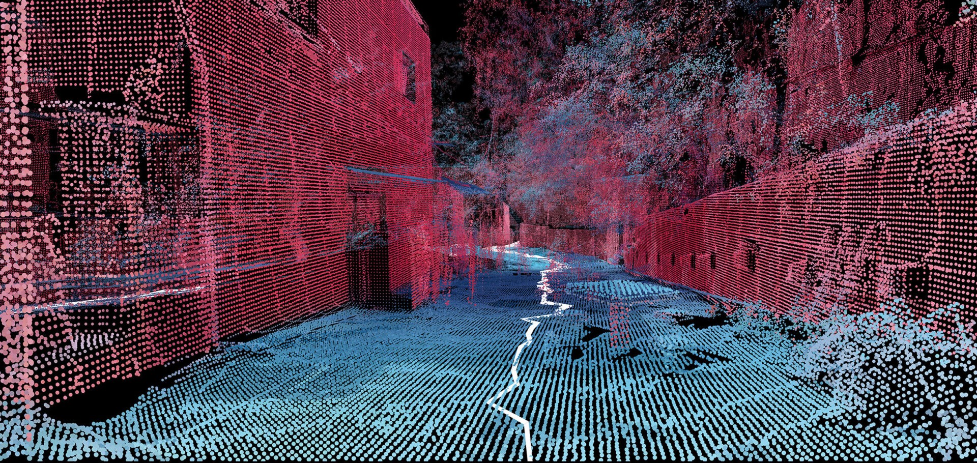
Mapping informal settlements
A team at the MIT Senseable City Lab mapped a Brazilian favela with handheld 3D-scanners. I’ll be honest, part of why I’m blogging this is that it just looks very cool! Called Favelas 4D, the project uses point cloud data from handheld LiDAR (Light Detection and Ranging) scans in order to study the form of Rocinha, a favela in Rio de Janeiro. The low-income urban settlements have complex structures that are built by their inhabitants over time. […] Fajardo entered Rocinha on foot and captured the data with a handheld LiDAR device that uses a laser pulse to measure distances. Tiny points are mapped to locations in space to create a dataset that reveals the intricate details of a 3D environment.